


Get inspired by our customers


Through CARTO we were able to gain insights on where to open new healthcare centers, generating market analyses that ensure profitability of potential sites & monitor performance. The attractive, easy-to-use interfaces allow a range of business units (marketing, sales, operations) to get value out of location data.


Healthcare Analytics
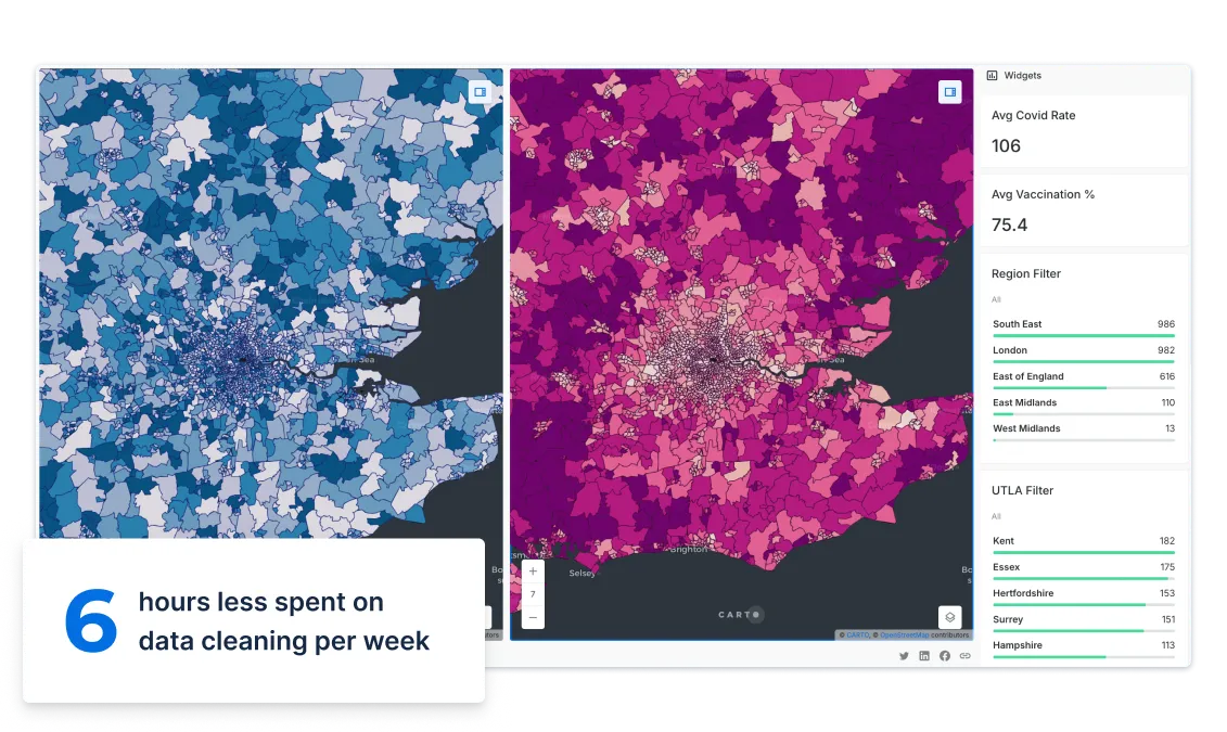
Making decisions that are beneficial to your population’s health isn’t easy - with so much health-related data in silos, different formats & systems.
Insurers, public health authorities and local governments choose our cloud native geospatial analytics platform, that runs on HIPAA-compliant clouds, to make critical decisions on resource allocation in their communities.

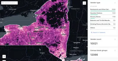
Site Selection
Whether you need to identify a location for a hospital, medical or dental clinic, or a vaccination centre - considering new data streams relating to health, catchment and population is fundamental to ensure superior customer/citizen service and a better return on investment for your organization.
Aligning your physical footprint with online health services isn’t easy between private and public initiatives - but using spatial analysis as part of that process is a game changer.
Territory Management
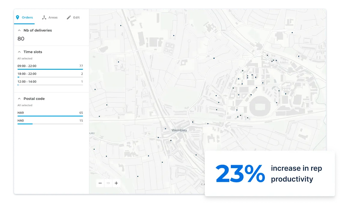
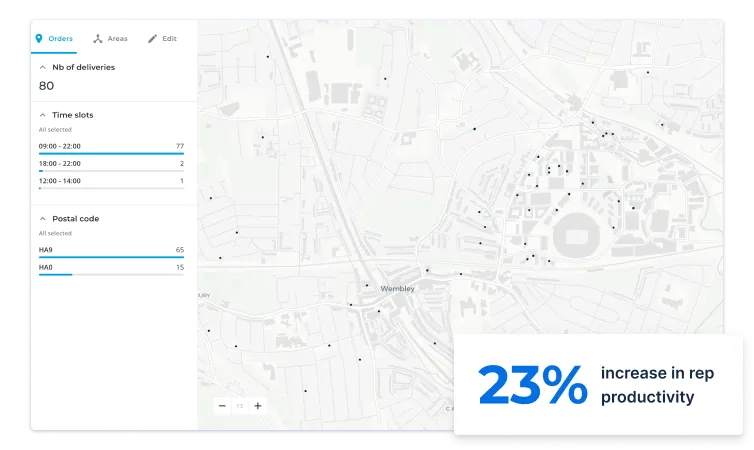
Optimizing your field sales performance by designing and balancing your territories using CRM data and medical points of interest has become a pharma industry standard.
Using spatial data to drive decisions leads to bigger and better deals faster, boosting sales rep productivity and reducing your field’s operational costs.
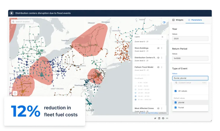
Supply Chain Network Design
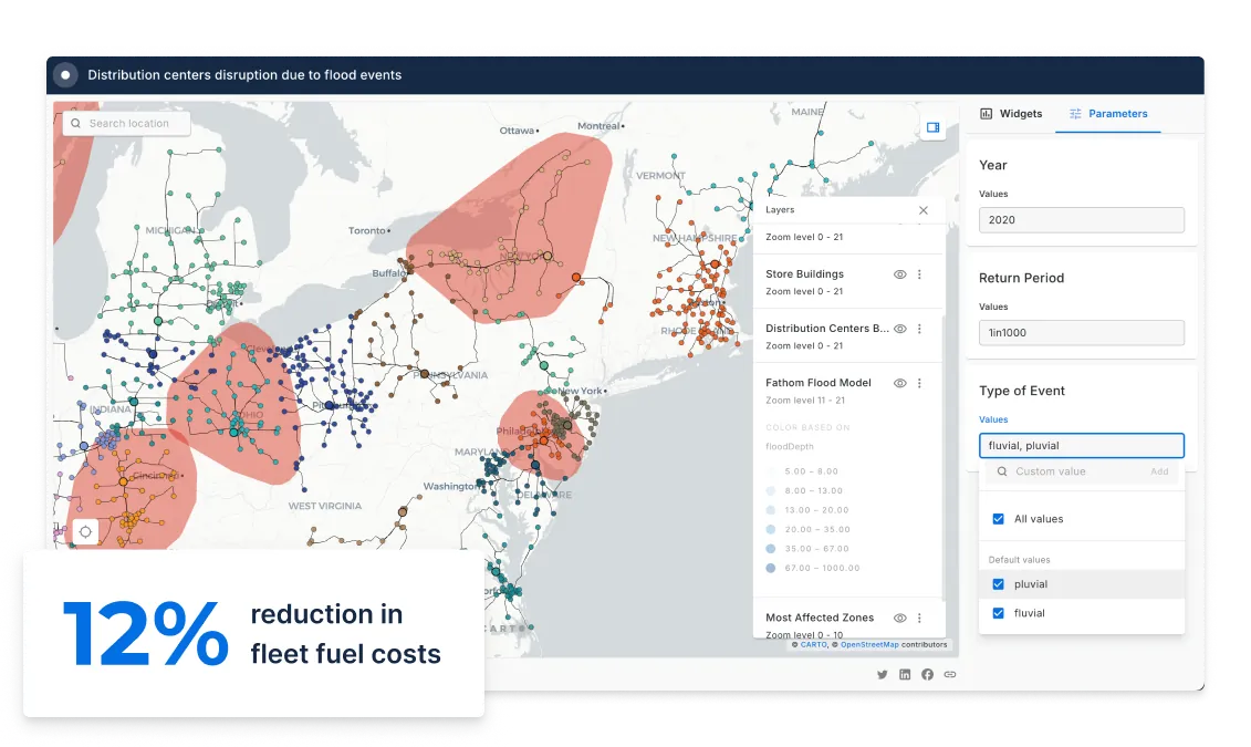
Maintaining a steady supply of pharmaceuticals and supplies to medical facilities and pharmacies, whilst ensuring the system is cost-effective is a challenging spatial problem.
Using location data streams to monitor distribution management as products move through the supply chain can lead to double digit savings for pharma brands.