


CARTO & Snowflake: Location Intelligence for Energy and Utilities
CARTO and Snowflake expanding cloud-native Location Intelligence for Energy and Utility organizations, unifying IoT data for resilient operations.


CARTO presenting at GEO Business 2021, UK’s largest geospatial event
We’re excited to announce that we’ll be attending & presenting at GEO Business 2021, the UK’s largest geospatial event, taking place on November 24 - 25 at ExCeL London.


Announcing the Spatial Data Scientist of the Year 2021
As #SDSC21 draws to a close today, we reflect on the conference & announce the winner of the Spatial Data Scientist of the Year Award!

Today Thousands of Spatial Leaders Gather for #SDSC21
#SDSC21 Online starts today! Join thousands of spatial leaders from around the world over 4 days to discuss & learn about the future of Spatial Data Science.

PMI, Litterati, & Clear Channel Win Geospatial Excellence Awards
We’re very pleased to announce that at this year’s Geospatial World Forum, CARTO clients Philip Morris International, Litterati & Clear Channel have all won awards.


CARTO Spatial Features, now with global urbanity, climatology, & elevation data
We are pleased to announce the release of a new version of CARTO Spatial Features, including new variables for urbanity level, elevation, & climatology

CARTO & Havas Media Group present at Big Data & AI World Madrid 2021
We’re excited to announce that we’ll be presenting alongside Havas Media at this year’s Big Data & AI World 2021 (part of the Madrid Tech Show).

CARTO & Google Cloud announce sustainability partnership to fight Climate Change
CARTO & Google Cloud announce a sustainability partnership to enable organizations to better understand climate change through massive geospatial datasets.


Announcing CARTO's Spatial Analytics in BigQuery
Today we announced at Google Cloud Next the General Availability of the new CARTO's Spatial Analytics in BigQuery. Learn more about the most innovative platform to perform spatial analytics natively in the cloud.

Spatial Data Science Conference '21: More Speakers Confirmed
The Spatial Data Science Conference 2021 brings together leaders from industry, government, & academia for four days of talks on the latest technologies & techniques.


CARTO selected for AI4Cities Phase 2 Sustainable Mobility Project
We are pleased to announce that we have been selected to participant in phase 2 of AI4Cities, a project to help cities accelerate their transition towards carbon neutrality

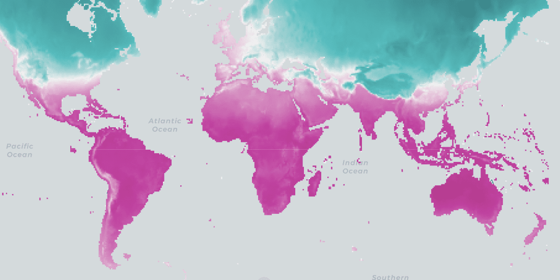
Climate Change & Extreme Weather: Hurricane, Wildfire, & Flood Maps
Climate change is contributing to extreme weather with increasing bursts of hurricanes, wildfires, & floods. See how maps can help plot, predict, & protect.
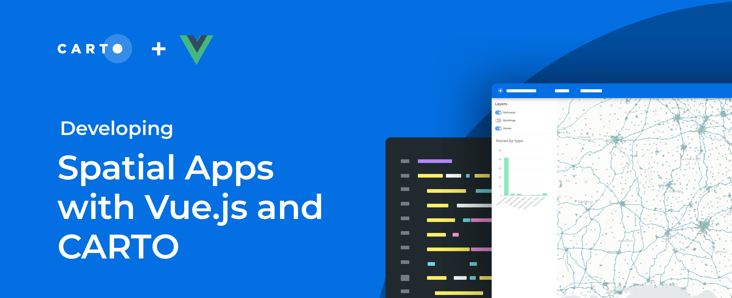

How to Build Scalable Spatial Apps with Vue.js & CARTO
Developing spatial apps with Vue.js? Check out our guide to how easy it is to integrate Vue.js applications with CARTO for deck.gl

Academy
CARTO & Snowflake: Location Intelligence for Energy and Utilities
CARTO and Snowflake expanding cloud-native Location Intelligence for Energy and Utility organizations, unifying IoT data for resilient operations.
Nagarro & CARTO: Advancing Enterprise AI Transformation
CARTO and Nagarro partner to help enterprises move AI from pilots to production, embedding Location Intelligence into existing workflows and systems.


Unlock trade-area analysis at scale with H3 Isochrones
Scale travel-time analysis with H3-based isochrones in CARTO. Faster joins, overlap insights, and 96–99% time savings powered by TravelTime.

