


CARTO & Snowflake: Location Intelligence for Energy and Utilities
CARTO and Snowflake expanding cloud-native Location Intelligence for Energy and Utility organizations, unifying IoT data for resilient operations.


Elevate your real estate property analysis with CARTO & Markerr
Announcing CARTO & Markerr's data partnership! Subscribe to spatial real estate data including transactions, rent and property details.
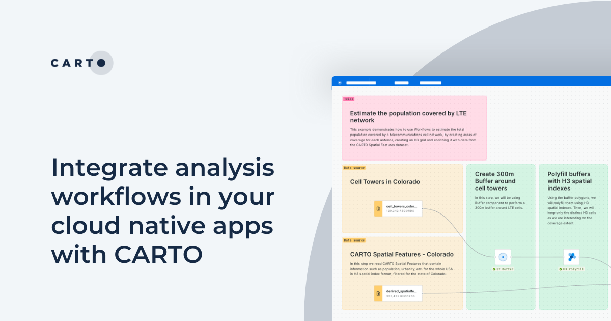


Integrate analysis workflows in your cloud native apps with CARTO
Seamlessly spatial analysis into cloud-native apps; trigger workflows via API, parameterize processes & seamlessly integrate them into spatial apps.

5 Advantages of No Code Spatial Analysis
Is no code for spatial analysis possible? Discover 5 advantages to go no code & see CARTO Workflows in action! Reduce bottlenecks, save time & de-risk.

Geographic Segmentation: How to get started
Get started with Geographic Segmentation with our guide & tutorials. Leverage demographic & consumer data to tailor your strategy & maximize ROI.
.png)

CARTO now available on Snowflake Partner Connect
CARTO is now available on the Snowflake Partner Connect portal - discover how to activate and get started today!
.png)
Modernizing the Geospatial Analysis Stack report - get your copy!
Level up your geospatial analysis with our FREE report! Modernize your tech stack for bigger, faster, and more collaborative spatial analysis.

What's New in CARTO - Q4 2023
Explore the latest CARTO platform features unveiled in Q4 2023! GenAI capabilities, pie chart widgets, data export enhancements - and more!


4 ways catastrophe analysts can use spatial analytics
Discover 4 different spatial analytics techniques Catastrophe Analysts can use to understand key climate-related risks for better insurance decision-making.
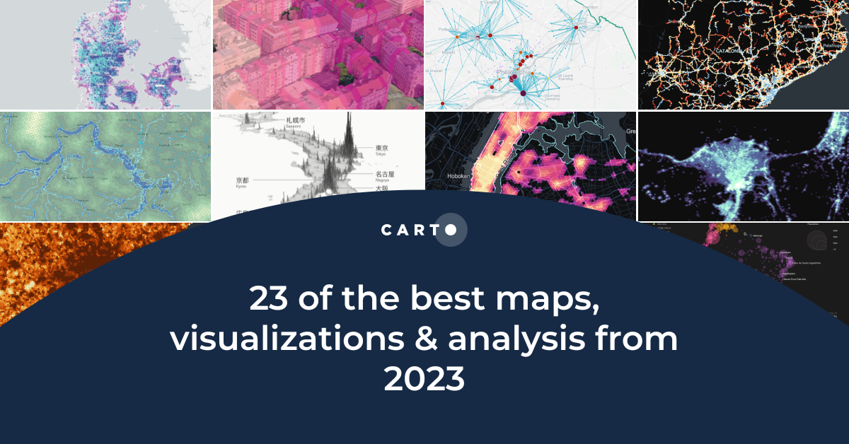
23 of the best maps, visualizations & analysis from 2023
Explore 23 of the best maps and visualizations of 2023. From advanced analytics to awesome visualizations with huge geospatial data.
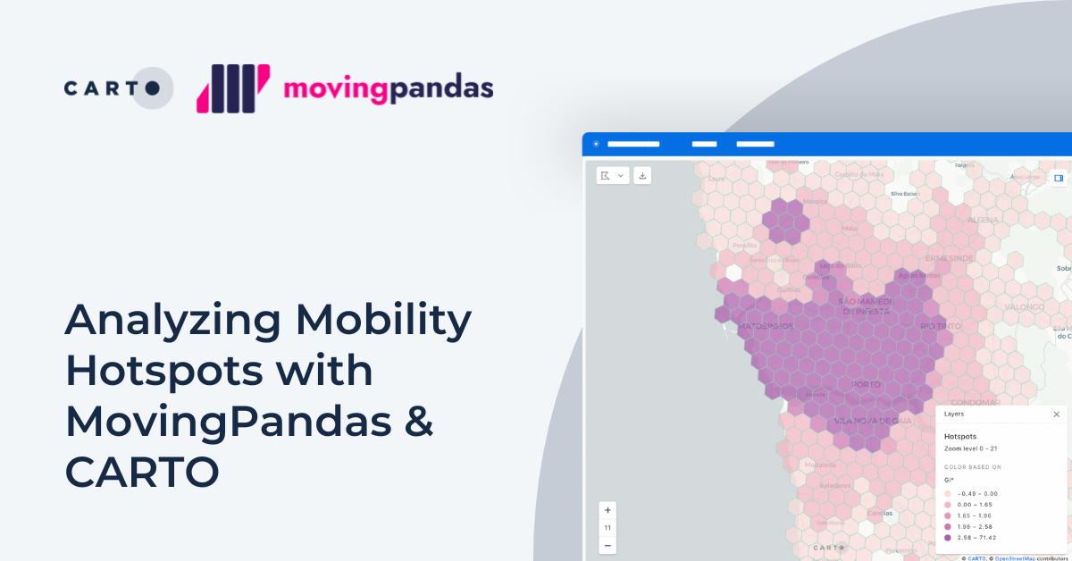


Analyzing Mobility Hotspots with MovingPandas & CARTO
Explore mobility hotspots with MovingPandas and CARTO. Tutorial on transforming trajectory data into space-time hotspots for intelligent decision-making.
.png)

Pie Charts: An Effective Data Visualization Tool?
A guide to creating Pie Charts for effective spatial Data Visualization & dashboards, including best practice and examples.
.png)
Using crime data & spatial analysis to assess home insurance risk
Discover how spatial analysis of crime data can be used for smarter home insurance decisions, including personalized underwriting & targeted marketing.

Academy
CARTO & Snowflake: Location Intelligence for Energy and Utilities
CARTO and Snowflake expanding cloud-native Location Intelligence for Energy and Utility organizations, unifying IoT data for resilient operations.
Nagarro & CARTO: Advancing Enterprise AI Transformation
CARTO and Nagarro partner to help enterprises move AI from pilots to production, embedding Location Intelligence into existing workflows and systems.


Unlock trade-area analysis at scale with H3 Isochrones
Scale travel-time analysis with H3-based isochrones in CARTO. Faster joins, overlap insights, and 96–99% time savings powered by TravelTime.

